
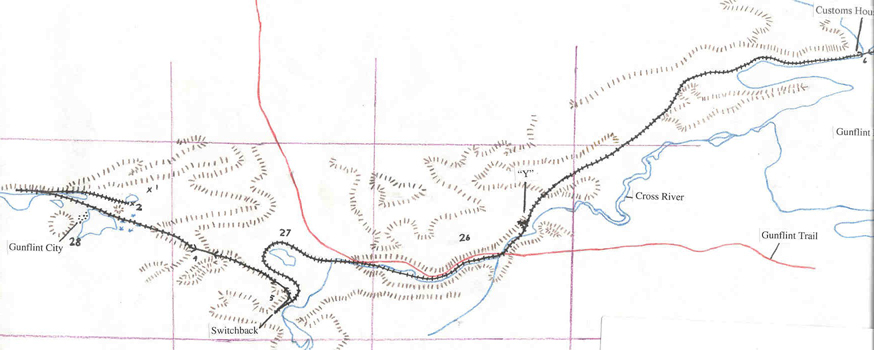
Maps
Here are some examples of maps and other information about the Port Arthur, Duluth and Western Railway.
Maps
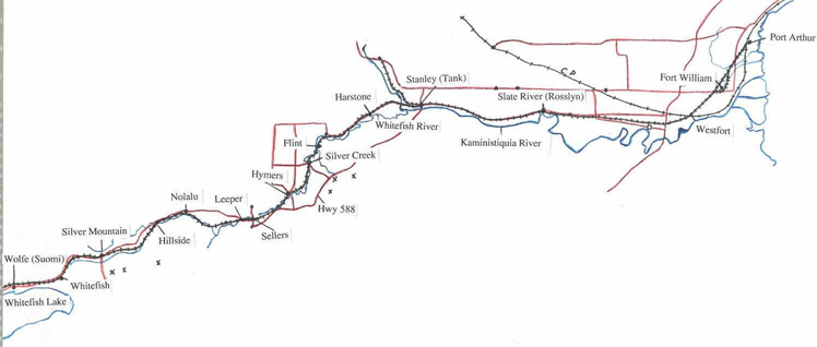

The Character of the Line
Length of the Line:
P.A.D & W - from Port Arthur to Gunflint Lake - 85.5 milesP.A.D & W of Minnesota - from Gunflint Lake to Paulson Mine - 5.75 miles
Cost:
P.A.D & W - $1,400,000 or $16,000 per mileP.A.D & W of Minnesota - $245,000 or $40,800 per mile
Total (including road & equipment) - $2,600,000 or $30,000 per mile
Character:
Gauge - Standard 4' 81/2"Weight per yard - 56 lb. Steel
Ties per mile - 2640
Fastening - Fishplate
Number of Curves - 265
Radius of Sharpest Curve - 573 feet
Length of Curved Line - 35.6 miles
Length of Straight Line - 49.9 miles
Length of Level Line - 25.8 miles
Heaviest Grade - 2%
Bridges:
Wooden - 3, Total Length 575 ft. (40 to 80 ft.)Trestles - 62, Total Length 4597 ft. (15 to 996ft.)
Buildings (as of date of sale):
Port Arthur - Station building & Freight shed, two storey, 16' x 50' - Engine shed, 132' x 35'Fort William - Station & Freight house, two storey, 16' x 32'
West Fort William - Station & Freight house, one storey, 16' x 32'
Stanley - Freight shed, two storey, 50' x 25'
Silver Mountain - Freight shed (logs), 10' x 20'
North Lake - Freight shed (logs), 26' x 40'
LeeBlain - Frame building, 40' x 24'
Buildings (added later):
Port Arthur (Canadian Northern Building)Flint
Hymers
Silver Mountain - Station & Freight house, two storey, 25' x 50'
North Lake - identical to Silver Mountain